Climate
From the Köppen climate classification, the majority of the Eastern Nile River Basin’s southern region has a Tropical Savanna Climate (Aw), with annual precipitation between 750 and 1,300 mm and clearly defined wet and dry seasons. The northern side of the basin is classified as BWh Arid, Desert, Hot, with very low annual precipitation (typically less than 250 mm), very high mean annual temperatures, and extremely hot summers (Beck et al., 2023; Kottek et al., 2006). Other climate classifications exist as well, such as the Hot Semi-Arid Climate (BSh), which receives an average of 250–500 mm of precipitation annually, more rainfall than deserts. Other categories are also infrequently recognized (Beck et al., 2023).
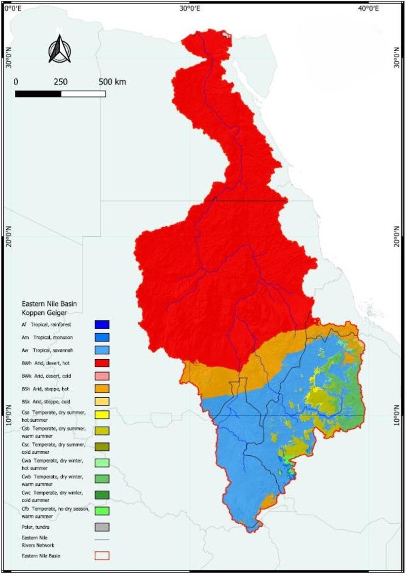
Figure 1: Spatial distribution of the Eastern Nile Basin Köppen-Geiger Climate zones. Source: ()
Precipitation
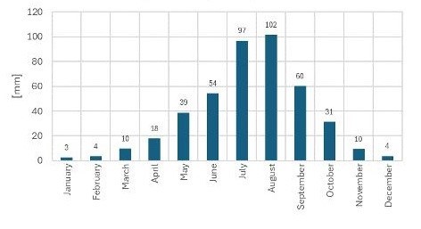
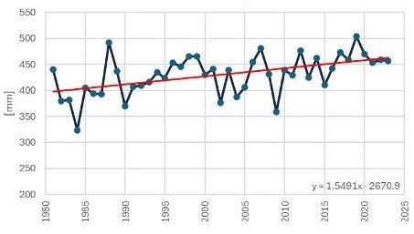
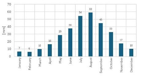
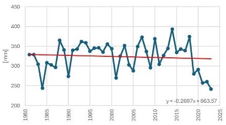
In the basin, mean annual precipitation ranges between 300 to 500mm, with a slight but steady increase in the average annual precipitation trend in the last 40 years (Mengistu et al., 2014).
Temperature
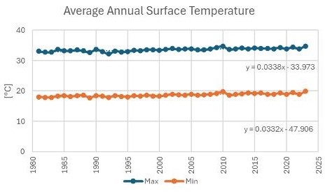
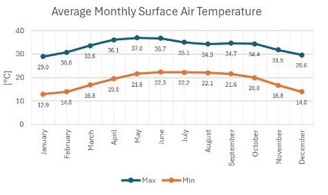
The range of annual average temperatures is 18 to 32ºC. The annual trend for both the maximum and minimum average annual air surface temperatures showed a small but consistent upward trend. The Khartoum region of Sudan experiences higher temperatures, with an average of about 40ºC. The lowest maximum and minimum temperatures in the entire Eastern Nile River Basin are found in Ethiopia’s northeastern mountain region.
Evapotranspiration
The highest evapotranspiration occurs in the wet season. This can be attributed to the fact that water availability increases dramatically in July and August and decreases in December and February. An annual trend toward decrease should be observed (Nooni et al., 2019).
Runoff changes
Most of the Nile’s waters originate from the Ethiopian Highlands, with the Blue Nile, Atbara, and Baro rivers contributing about 85% of the annual flows but showing significant wet and dry spells. In contrast, the White Nile, fed by several rivers from Ethiopia and the Equatorial Plateau, provides about 28% of the Nile’s flow with stable discharge year-round. The Tekeze/Atbara River, also from the Ethiopian Highlands, contributes around 13% to the Nile. The main Nile, starting at the Blue-White confluence in Khartoum, generates almost no runoff downstream (Nile Basin Initiative, 2021). The average discharge on the Eastern basin tends to decrease even if the average precipitation isincreasing.
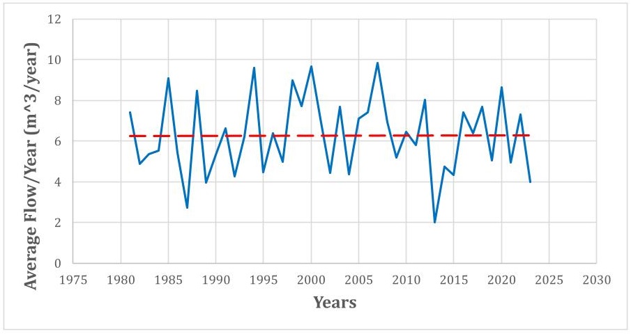
Figure : Temporal distribution of mean annual runoff (m3/year).