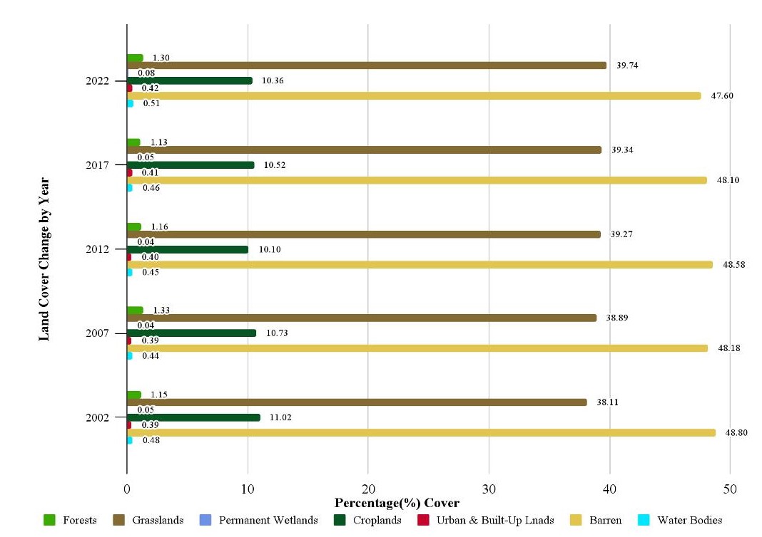
The Eastern Nile Basin (ENB) is predominantly barren land (48%), with grasslands (39%), croplands (11%), and forests (1.30%). From 2002 to 2022, there were significant shifts in land use, including losses in croplands (6.36%) and barren lands (2.51%), totaling 12,736 km² and 23,078 km², respectively. Grasslands and permanent wetlands saw increases, with wetlands growing by 28%. Major transitions involved 59,065 km² of croplands turning into grasslands, and 25,853.71 km² of barren land becoming grasslands. Forest cover declined, losing 4,500 km² to grasslands, and grasslands lost 46,571.06 km² to croplands (Friedl & Sulla-Menashe, 2019).

Figure 1: Percentage of land cover changes in the Eastern Nile Basin per land cover category.

Figure 2: Spatial distribution of land use land cover in the Eastern Nile Basin 2002-2022.
References
Friedl, M., & Sulla-Menashe, D. (2019). MCD12Q1 MODIS/Terra+Aqua Land Cover Type Yearly L3 Global 500m SIN Grid V006 [Dataset]. NASA EOSDIS Land Processes Distributed Active Archive Center. https://doi.org/10.5067/MODIS/MCD12Q1.006.